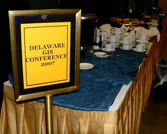
 We are hosting a statewide conference for the users of GIS tools and geospatial data in Delaware this week. It is called Delaware GIS 2007: Serving Communities.
I should probably take a moment to explain GIS. The acronym stands for Geographic Information System, the combination of the map and the database. We use information about where things are to create what we refer to as "geospatially intelligent" information.
My job is to encourage the use and sharing of geospatial information in Delaware. The annual GIS conference is a big part of that.
Most of the credit for putting on this show, this year and every year, is due to the other folks on the Conference Planning Committee; but I get to play EmCee each year to all the state, local, academic, and private sector GIS folks in Delaware. It's a job I love.
The Conference started today with a series of technical workshops. While those were going on, we were getting ready for the main day of the conference and helping our exhibitors get set up. This evening, we hosted a social as a way of getting our exhibitors a bit more face-time with local GIS users.
Tomorrow we'll have about 200 attendees at the Dover Sheraton Inn. We start with a main session featuring awards and a Keynote address. We'll have workshops and presentations, a big lunch, more workshops and presentations, time with our exhibitors, and a closing session featuring another keynote and door prizes.
It will be exhausting, but during a long, long day I'll have a chance to catch-up with lots of folks doing great work. I'll see some of them honored by their peers. We'll inspire each other. We'll laugh and have fun.
I love my job sometimes.
1 comment:
This sounds fascinating ! I am wondering if you would be interested in S.B. 89 that was introduced today: AN ACT TO AMEND TITLE 29 OF THE DELAWARE CODE RELATING TO GEOSPATIAL DATA.
Sounds like it's right up your alley.
Post a Comment
Note: Only a member of this blog may post a comment.