A blog called
Strange Maps has started looking at Delaware's rather unique border. There are two posts, so far. It's interesting to see the various oddities of my state's boundary discussed by an "outsider." I advise bringing along a pinch of salt to take when you read the Strange Maps posts, there are a few very minor mistakes.
My day-job involves mapping, geospatial data, and working with things like the border in Geographic Information Systems (GIS) software. I also work closely with my friend Sandy Schenck of the Delaware Geological Survey. Sandy's first job, many years ago, was finding and maintaining the 179 stone boundary monuments that mark the Delaware border. He wrote
a wonderful monograph on the boundary. That's my authoritative source on these issues.
The images I've used in this post, by the way, were created using the Delaware Data Mapping and Integration Lab --
The DataMIL -- which provides a digital base map of Delaware, replacing the old paper topographic map series with a more frequently updated, web-based, topo map.

The first Strange Maps post is
Where Delaware Met Pennsylvania (1): the Twelve Mile Circle. It looks at the odd border issues caused by the decree in colonial times that a circle with a radius of 12 miles, centered on the town of New Castle, be used as a boundary.
Strange Maps describes this as "the only US boundary that’s a true arc." That's sort-of true; it's the only one that is circular. It is not, in fact, a true arc. The chain used to measure the 12 miles and so to survey that part of the boundary, had to be stretched out over and over again. The links started to stretch, just a bit, throwing off the measurements. Somewhere along the line, the surveyors got themselves a fresh chain, at least once.
The result is a boundary that is a compound of degraded arc sections. Subtle, and maybe even silly. But true.
Strange Maps also points out that the boundary was described as everything within the 12 miles up to the shoreline of what is now New Jersey. The result of that, and of a 1930s Supreme Court decision, has been that the state boundary is, in fact, the mean-low water line as it existed in 1934. There are places where the shoreline on the Jersey side has filled-in and moved out, by accretion, to where it now lies within Delaware.
We try not to point this out too explicitly; it upsets our neighbors in New Jersey. That, and the fact that Delaware regulates what happens over the river bottom, which has so far stymied a proposed Liquid Natural Gas terminal in the Camden area.

The second "Where Delaware Met Pennsylvania" post
looks at the "Wedge". This is a wedge-shaped bit of land that for a time was not in Delaware, not in Pennsylvania, and not in Maryland. It was another anomaly caused by the 12-mile circle and by a disconnect between what 17th-Century cartography expected to find and what 17th-Century surveying actually did find.
It's that bit beneath that "shelf" where the three states meet. Just above Newark.
I understand that it was briefly a haven for outlaws, who would flee there because no lawmen had jurisdiction. At least, until the states got together and decided to make it part of Delaware.
This almost forgotten bit of history lives on in some of the place names north of Newark like "Top of the Wedge" or "Wedge Hills."
These are just a few of the many strange truths about the Delaware border. For example, many of us in Delaware actually live
east of the Mason-Dixon line. They drew our western boundary before turning west to create the part of the line that they are most known for.
Also, the Delaware boundary is the only one in the marked, in part, with boundary monuments made of stone from a different country. Mason and Dixon used a "light buff oolitic limestone cut on the Isle of Portland, Dorsetshire, England" to mark parts of the line.
The Delaware Geological Survey maintains
a database of the boundary markers, some of which
can be visited.
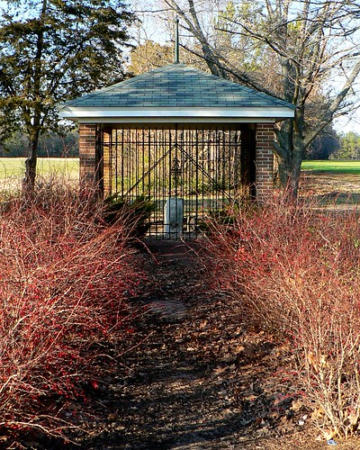
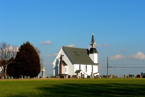
 I took advantage of my long drive home from Annapolis last week to visit a few more boundary monuments in western Sussex County. Inspired by finally making it out to see The Middle Point last month, I planned my drive in part by taking a look at the locations of Delaware boundary monuments using the Delaware DataMIL (zoom-in a bit on the border and select "Boundary Monuments" in the layer list).